It's mostly a series of stories of failed strategics ending in massive loss of lives. Military staff had a particularly hard time grasping the shifted realities of modern warfare. This resulted in a series of ill faithed attempts to break through the stalemates that existed since the German Schlieffenplan failed. This attempt to quickly take the North of France, taking Paris from the West, thus outflanking the French armies and bringing swift victorie. The French however just managed to bring the Germans to a halt along lines that wouldn't significantly change during most of the four years the war would last. In a zone stretching 40-50 kms wide leading from Nieuwport at the Belgian North Sea shore to Switzerland the parties engaged held eachothers in a deadlock for most of the time, which is not the recipe of a great story. Most of the time the opposing armies would be sheltering in their system of trenches, dodging the occasional shelling and small arms fire, which was gruelling and often deadly but preferable to the several attempts at a breakthrough, by High Command refered to as the Big Push, ususally ending in a 'dud show' as the participants would call the massacres at Loos, the Somme and Passchendaele to name but a few.
The day-to-day accounts of the procedings in 'the line', of living under highly challenging circumstances of mud, foul weather, shelling, gas, fear of death, loss of friends, following orders no matter how arbitrary and so on somehow produced subject matter for a couple of the most interesting books I've ever read. Henri Barbusse's 'le Feu', Ernst Jünger's 'Stahlgewittern', Robert Graves' 'Goodbye to all that', Siegfried Sassoon's 'Memoirs of a foxhunting man' and Edmunds Blunden's 'Undertones of War', are the authors probably best known, but there are many others give compelling accounts of all facets of the war that never fail to blow the readers mind. Or this readers mind, you can be the judge of that.
As I wrote I was in Verdun when I was barely 15 and ten years ago I spent a couple of days cycling in the surroundings of Ypres, seeing most of the sites in the infamous Ypres Salient which is rougly at the other end of the front. In the summer of 2010 I found myself with some time and a bicycle on my hands and it seemd like a nice project to cycle all the line, from Switzerland to the North Sea. I wanted to see some of the places where the afore mentioned writers had been posted and had significant experiences and wrote about. I thought that cycling the line, instead of motoring it, would give me a better idea of the size of it. It's not the same as marching, which the armies mostly did to travel back in the day, but the next best thing I guess. I used a hybrid bike carrying about 15 kgs of baggage, which is nowhere as bad as the packs the soldiers would use to carry on their backs but in any case I was at least hauling weight over these french hills and mountains and experience some burden. Hardcore aficionados of the Great War should bear in mind that this blog is first and foremost a travel blog and this entry is as much about the joys of cycling as an account of my visits of some sites along the Western Front. You won't find any comparisons between the Minenwerfer and its Allied counterparts here.
I planned to trave South-North and start at the Swiss border and have the Vosges mountains over with on the first day. That's why I took a train to Mulhouse, just north of Basel (Sw) on saturday the 31st of July 2010. From there I started the next day. The purist might add here that Mulhouse was already within German territory when the war began and no trench nor significant battle was ever there. To this purists I'd like to give kudo's, but on the other hand, one has to be practical and deal with limitations in time and money. That's why I started in Mulhouse, Alsace, on the 1st of August.
1 Aout. Première étape: Mulhouse (alt. 235 m)- St-Die-des-Vosges (107 kms) via Col du Bonhomme (alt.949 m)
A sweeter landscape to cycle in like the bit of Alsace between Mulhouse and Colmar is hardly imaginable, esspecially on a sunny sunday morning with the village churchbells calling the faithfull to church. Under such lush circumstances it's an easy and lovely ride to Colmar, a wonderful German medieval town with lots of wonderful sights unrelated to the war. It would be unwise to pass this town by without having given its sites a proper look see, for instance the works of the 15th Century painter Martin Schongauer.
I couldn't spend that much time there because I had no idea how much time it would take me to cross the Vosges. I'm a heavy set, middle aged geezer with no talent for climbing at all so I was a bit worried if I could succesfully pass that 700 meters of elevation without much training.
It was by no means a walk in the park but still quite do-able if one is used to cycle regularly. There's hardly any really steep, hairpin-infested roads, it's mostly long, steadily rising slopes that do tend to get a bit steeper once one gets closer to the top. Some 6 kilometres before the col there's the village of Bonhomme, which provides an excellent excuse to take a break and some soda's after which one can cover the remaining distance rested.
 Col du Bonhomme, plaquette in honour of General Bataille c.s. who fell there on 8-9-1914
On top of that col I saw the first battlefield monument, one of the few offensive french actions of the first weeks of the war. From there, it's mostly all downhill in the directions of st. Die, which is most welcome after the ascent. Should you have more appetite for climbing, there is a side road leading to a series of mountain crestst that played an important part in the initial phase of the war. I couldn't be bothered, in the light of the whole war they were mere bagatelles as the French would put it, the climb up there would have been a bit too much for me. So I made it to st. Die, a city that tries really hard but isn't succeeding.
2 Aout. Deuxième étape. St-Die-des-Vosges - Pont-a-Mousson via Nancy (128 kms)
After I had explained the splatter of red wine stains on the curtain to my hotellier (something to do with the presence of a bottle of wine and the absence of a corkscrew, you do the maths), I stepped on my bike with a clear consience but under a rainy sky. The first bit to Raon l' Etape went along quite small 'routes departementales' and villages.

A challenging thought: Holland is not a 'middle sized, important guide country' but a hamlet in the hills
After Raon, I was reminded that routes departementales may also be a bit broader but a lot busier, with loads of trucks rushing by, which can be a bit unsettling in the rain. Along the road one can see memorials to the 2nd WW, like signs marking 'la voide du Liberte', the route used by the Americans to oust the Germans in 1944-45.
 Interesting idea to keep the European ideal awake; giant duracel rabbit on a roundabout near Raon l'Etape.
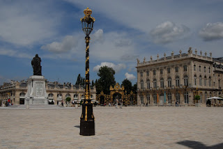
Between Luneville and Nancy there's plenty of safe and quite roads through farm lands. Nancy possesses some unexpected architectural gems dating back to the 18 th Century when this capital of Lorraine was enlightendly ruled by the the deposed Polish king Stanislas. The locals call the monumental palaces and squares their own Versailles.

Place Stanislas, Nancy, Lorraine.
Nancy is a nice provincial town that suffered some damage by long distance shelling during the war but has no realted landmarks to speak of. It does has a couple of industrial zones along it's river and canals. North of town there's a couple of hours of marvellous cycling on flat roads all along the river Moselle to Pont-a-Mousson, the first town of this tour seriously afflicted by the war.
3 Aout. Troisième étape. Pont-a-Mousson - Verdun via Croix de Carmes, Thiaucourt-Regnieville, st. Benoit en Woevre, Woel, Hannonville, Fresnes, l' Epargnes, Ronvaux and Eix (90 kms).
The salient was a result of a failed German attempt to outflank Verdun during the first month of the war. They did succeed in taking saint Mihiel which they held for almost the duration of the war, untill the Americans started their offensive in 1918. Most monuments and cemeteries are dedicated to the 'doughboys', as the US soldiers were known.
I started this day early, leaving the D-roads for small roads in the wods and fields, along monuments, trenches, craters and bunkers. My guide was that of the Holts, which is very extensive and thourough but pretty soon it's clear it's impossible to see everything unless one would a couple of months. The guide is made for motorists so a cyclist should make a selection and adapt the routes which I started doing right away.
 Barbed wire and old trenches at dawn, in the woods around la Croix des Carmes
It was after all not my intention to see ALL places of importances along the frontline. That would be a difficulty in itself, because static though the line may have been, minor changes were made and even bigger changes in 1918 so I decided to aim at what would amount to 'an ideal line' between those different lines, to describe it with a cyclist term.
 German bunker in the st. Mihiel Salient
 Last remaining shop in a small village in Woëvre, in the st. Mihiel salient.
 German bunker in the st. Mihiel Salient
It's perfectly possible to read enough about the area to form an idea what was going on there and still be able to enjoy the surroundings. For a Dutch person it's amazing to see all these fields and woods without running into too many people. France is blessed with a lot of open space which adds to the holdiday experience. Many times I came across deer, owls and other interesting wild birds. As a matter of fact, esspecially in the less visited parts of the line in the South East, one comes across what are now the most pastoral pieces of France. Bigger contrasts between what one sees around one and the hellish landscapes on the pictures in guide books are hardly imaginable.
 Doughboy and poilu monument in Thiaucourt in the st. Mihiel salient
Some would call 'pastoral' 'dead', because not many people live in these rural parts of France and admittedly, many of these small villages show few signs of life. Most of the shutters are closed even on advanced hours of the day and it's not uncommon to pass several villages in a row without seeing a living soul in the street. In the dutch guidebook 'Velden van weleer' by Chris and Keesje Brands, the authors suggest that this lack of liveliness in the villages all along the former Western Front is due to the atrocities and destruction they witnessed. The villages are ashamed and dare not really live again. Which is a crackpot theory. Death and destruction never kept Berlin and other sites of atrocities from rising from the ashes. In my humble opinion, there's just not enough work in these places and young people leave their agricultural home towns and go live in the cities, like everywhere else in the world. Most of the villages don't have any stores an cafe's anymore. The slightly bigger ones have an Aldi or Lidl supermarket, you have to look really hard to find a nice shop or watering place in most towns, which is dissapointing to say the least. The upside of this is that the prices of real estate in rural France are quite affordable...
 Last remaining shop in a small village in Woëvre, in the st. Mihiel salient.
In the North-Western corner of the Salient there's the village of l'Eparges which sits at the base of a 1400 m long and 380 m high ridge of hill which practically overlook the whole of the Woëvre plain and was therefor the object of bitter fighting during the war. The Germans possessed the strategically attractive high grounds which compelled the Allies to struggle up these hills, or tunnel and mine them, as happened in the Argonne woods, the hills of the Chemin des dames, the Somme and other places along the Western front.
 Monument to the French 12th Rgt. upon the Eparges crest.
Even on a beautiful August day one can have the whole crest to oneself, maybe there was a footbal match I was unaware of. l'Eparges is an interesting place with one of the three 'Kronprinz Bunker' I saw along the line. It was also the site where Ernst Jünger saw one of his first battles. It looks lovely but the woods had dissapeared completely after the war and it took some time before they came up with a type of fir that flourished on these battered hillsides.
 Somehow the word had got out there about my cycling tour, but apparently there weren't enough living people left to cheer me, or they were still too ashamed about the atrocities mentioned earlier by Keesje Brands
 Monument to the French 12th Rgt. upon the Eparges crest.
 Somehow the word had got out there about my cycling tour, but apparently there weren't enough living people left to cheer me, or they were still too ashamed about the atrocities mentioned earlier by Keesje Brands
After an hour or so browsing the sites of l'Eparges I continued my tour in the direction of Verdun. After two days of cycling fairly easily I thought I could see some of the sites there, before pressing on to ste. Menehould, having learned that there weren't any affordable hotel rooms in Verdun anymore. However, I must have been looking the other way when I got knocked over the head by the proverbial Man with the Hammer. Just some 10 kms before Verdun I started feeling completely drained of energy with pain in the knees and achilles heel to top this up. There was no way I could go rummaging the sites of Verdun, situated on a plain out of town some 500 m higer than the town itself. I needed to quit cycling pronto and head to a hotel, rien a faire.
2 comments:
Ha Peter, leuk blog! Ik was in dezelfde tijd in dezelfde buurt. Heb je helaas niet zien fietsen. Grt Maud
Hoi Peter, al lezende komt het allemaal weer terug... mooi verhaal. Groet, Simone
Post a Comment